WASHINGTON 2024
Rollin’ on the Rivers
July 13 - 20, 2024
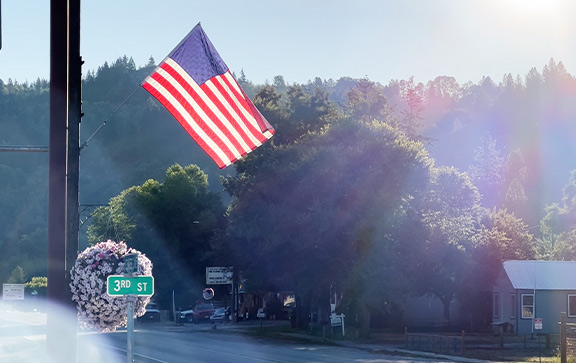
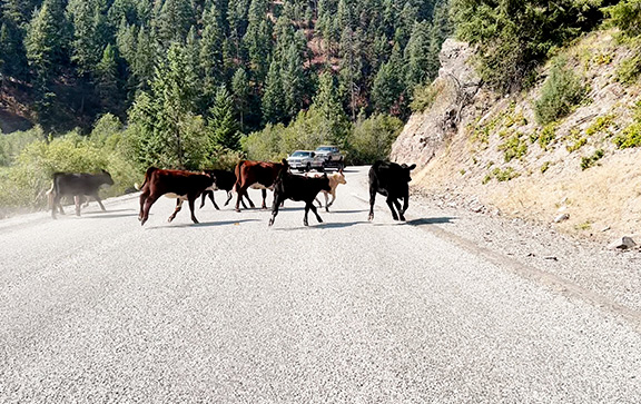
There’s a bit of riding paradise tucked away in the northeast corner of Washington, and we’re going to hit all the highlights. The locals love that few people venture this way, because the backroads are both scenic and quiet – but they’re also proud f where they live and are excited to show it off to you.
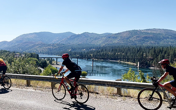
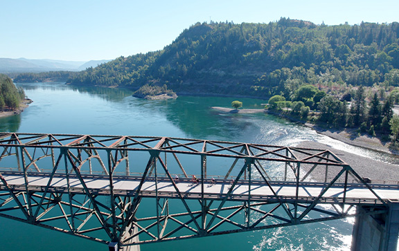
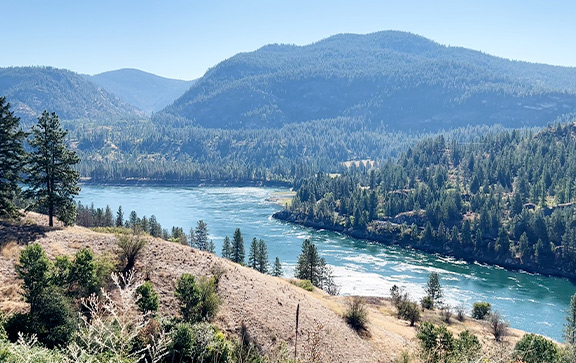
The theme says it all: We’re surrounded by, and often riding alongside, rivers all week. This rugged terrain has channeled snow from the Rockies into some of the most splendid rivers in the West. It’s a bit mind-boggling to realize that the same Columbia River that splits the Gorge between Oregon and Washington as it sweeps downriver and past Portland is also really big up here.
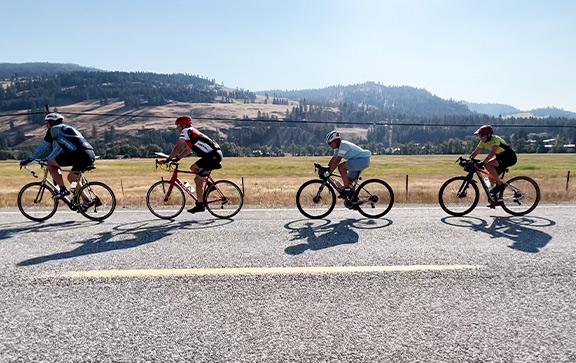
Each town along the way – and they’re all some degree of small – has authentic charm and distinctive character. After a day of pedaling, you’ll enjoy rolling into the next community to see what they have in store for us. That’s the rhythm of this week: Ride the spectacular routes, then arrive at the welcoming towns. It’ll be a relaxed yet invigorating week!
Rider Feedback:
“The routes were just fabulous, roads that I would never have experienced on my own.”
WASHINGTON 2024 ROUTE DETAILS

| Day | Description | Distance (miles) |
Elevation Gain (feet) |
|---|---|---|---|
| 1 | Colville to Northport | 54 | 3,010 |
| 2 | Northport to Curlew | 65 | 5,520 |
| 3 | Curlew to Oroville | 55 | 3,420 |
| 4 | Oroville Layover: Palmer Lake Loop | 50 | 2,290 |
| 5 | Oroville to Republic | 64 | 4,420 |
| 6 | Republic to Colville | 56 | 4,200 |
| 7 | Colville Layover: Local Highlights | 64 | 3,060 |
| TOTAL | 408 | 25,920 |
WASHINGTON 2024 DAILY ROUTES
Day 0 – Saturday, July 13: Check-in, Colville
Site Location: Yep Kanum Park Map
Local lodging (PDF)
Riders will come from far and wide, and converge in Colville. It’s like a family reunion you really look forward to. Check in after 2 p.m., get your tent set up, wander down to the river, reacquaint yourself with old friends and get yourself primed for a week of adventure.
Day 1 – Sunday, July 14: Colville to Northport – 54 miles, 3,010 feet of gain RWGPS route file
Site Location: Northport High School Map
Local lodging (PDF)
Get ready for a first day that embodies what’s great about this week’s route: Every few miles you’ll see something different and beautiful. You’ll head north through ravines and rolling fields, forests and valleys, and eventually be so close to Canada that you can see it from the road. The finale is to drop steeply down to the Columbia River, our near-constant companion this week.

Day 2 – Monday, July 15: Northport to Curlew – 65 miles, 5,520 feet RWGPS route file
Site Location: Curlew Elementary & High School Map
Local lodging: There is no lodging available in Curlew.
Let the motor vehicles follow the main highway; we’re going the back way. After crossing the Columbia, you’ll ride a country road high above the water for miles of grand views before dropping down to the confluence of the Columbia and the Kettle. After riding upstream along the second river of the day, a left turn will take you onto the first real climb of the week, 3,000-plus feet up to Deer Creek Summit, before an equally precipitous descent into the tiny town of Curlew.

Day 3 – Tuesday, July 16: Curlew to Oroville – 55 miles, 3,420 feet RWGPS route file
Site Location: Osoyoos Lake Veterans Memorial Park Map
Local lodging: No motels in Oroville; check here for rental properties.
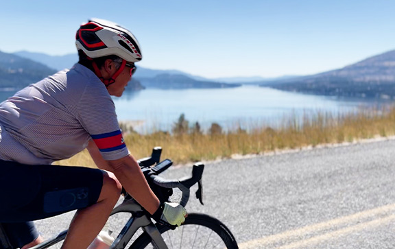
Start your day with a relaxed stretch along the Kettle River, and then take a turn into one of the quietest forest roads around. It’s a gentle climb through the deep forest for 20 miles, punctuated by a gorgeous rest stop at picturesque Beth Lake. After a short descent into the tiny, rough-and-tumble town of Chesaw, go to your mental happy place as you climb 6 miles to a windswept summit. Then enjoy an absolute thrill ride down into Oroville and the Okanagan Valley.

Day 4 – Wednesday, July 17: Oroville Layover: Palmer Lake Loop – 50 miles, 2,290 feet RWGPS route file
Site Location: Osoyoos Lake Veterans Memorial Park Map
Local lodging: No motels in Oroville; check here for rental properties.
Layover days can be secondary routes, or showcases. This day is spectacular. After a testy little climb out of town, this counterclockwise loop past Palmer, Spectacle and Whitestone lakes starts by following the water-carved canyon of the Similkameen River (you’re tuning into the ride theme here, right?). Trade rivers for lakes as you pass three camera-worthy ones before turning back north along yet another river: the gently undulating Okanagan.

Day 5 – Thursday, July 18: Oroville to Republic – 64 miles, 4,420 feet RWGPS route file
Site Location: Republic High School Map
Local lodging (PDF)
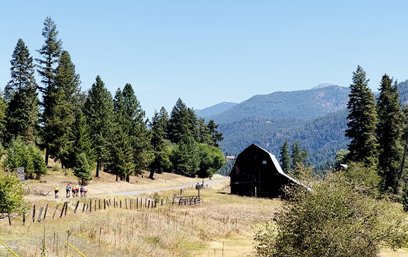
Today starts with an easy 10 miles down the valley, before the real fun begins. After a rest stop in Tonasket, you’ll get back in the wild as you climb triumphantly for 30 miles and enter the Kingdom of Wauconda. Oh, wait – wrong Wauconda. But you’ll take a brief side trip for a stop at the historic Wauconda Community Hall before finishing to the summit and then delighting in another descent to our destination in Republic – probably the most picturesque town on the route.

Day 6 – Friday, July 19: Republic to Colville – 56 miles, 4,200 feet RWGPS route file
Site Location: Yep Kanum Park Map
Local lodging (PDF)
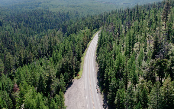
If you haven’t already figured this out, we’re criss-crossing the outlying fingers of the northern Rocky Mountain range. So yes, one last ascent to conquer, and it’s over the highest year-round pass in Washington. Start your day on a lovely new bike trail, then rejoin Highway 20 and tune in to the trees and birds and small waterfalls as you work your way up, up, to the summit at 5,500 feet. It’s not a punishing climb, and it’s more than paid off by a 20-mile glide down to the Columbia. Rip it or relax it; once you get to the bottom, enjoy the mostly flat zig-zag back to Colville.

Day 7 – Saturday, July 20: Colville Layover: Local Highlights – 64 miles, 3,060 feet RWGPS route file
Site Location: Yep Kanum Park Map
Local lodging (PDF)
When we decided to have a layover at the end of the route, we asked some local friends: Where do you ride? This route is a compilation of the best riding in the area that you haven’t already done. Head out of town and into rolling valleys, enjoying some of the little-used old roads that predate the highway. You’ll have a choice to ride or skip an 11-mile out-and-back section, and the route finishes with a circumnavigation at the base of Colville Mountain. As you pedal back into town, try to pick your favorite route of the week… good luck!

WASHINGTON 2024 RIDE LOGISTICS
Start Location
We’ll meet on Saturday, July 13, in Colville, at Yep Kanum Park. The street address is 356 E. Dominion Ave., Colville, WA 99114, for navigation.
Check-In
Check-in is on Saturday, July 13. We’ll be setting up camp in the morning, and our registration check-in station doesn’t open until 2 p.m. – we ask that you don’t try to come in and set up early; go check out the town! Dinner begins serving at 6 p.m., so it works best if you plan to arrive between 2 and 5 p.m. Check-in will stay open until 7 p.m.; if you arrive later than that, we’ll check you in Sunday morning or after the Day 1 ride.
Driving to Colville:
From the Portland area, allow 7 hours; from Bend allow 8 hours; from Seattle, allow 6 hours.
Parking
Long-term parking will be in an adjacent parking lot; signs and helpful crew members will direct you to the right spot.
Flying In
The nearest commercial airport is Spokane International Airport (GEG; most major domestic carriers); it’s 77 miles from Colville. Colville Municipal Airport is available for private or charter aircraft.
Shuttle Service
If you’re interested in a shuttle from Spokane Airport, please email us. We’ll compile a list of interested riders, and we’ll arrange a shuttle service of some kind.
Overnight Lodging
Colville has several lodging options; see them here.
Connect With Us
Contact
Newsletter
Sign up for our newsletter, to get all the BRNW news first.
Route History
Want to see everywhere we've been since 1987?
Click here for a PDF of all our routes since the humble beginning.
Imagery Credits
The following people have contributed photos and/or videos to the website:
- Burk Webb, Derailleur Films
- Phil Bard, Bard Photography
- K’Lynn Lane, Memory Lane Photography
- Terry Poe, Poe Photography
- Mike Westby
- Jim Moore
- Alice Bonham
- Bill Buckley
- Miranda Morehouse
- Jack Newlevant